Going North: 7 Reasons Why I Love Baguio

Baguio City, also known as the City of Pines, is a beloved destination in the Philippines for many reasons. As a travel enthusiast, I have had the opportunity to visit this beautiful city multiple times and each time I leave, I find myself planning my next trip back. I fell in love with Baguio City for its natural beauty, cultural heritage, delicious food and so much more. And here are 7 reasons why I keep coming back to Baguio City:

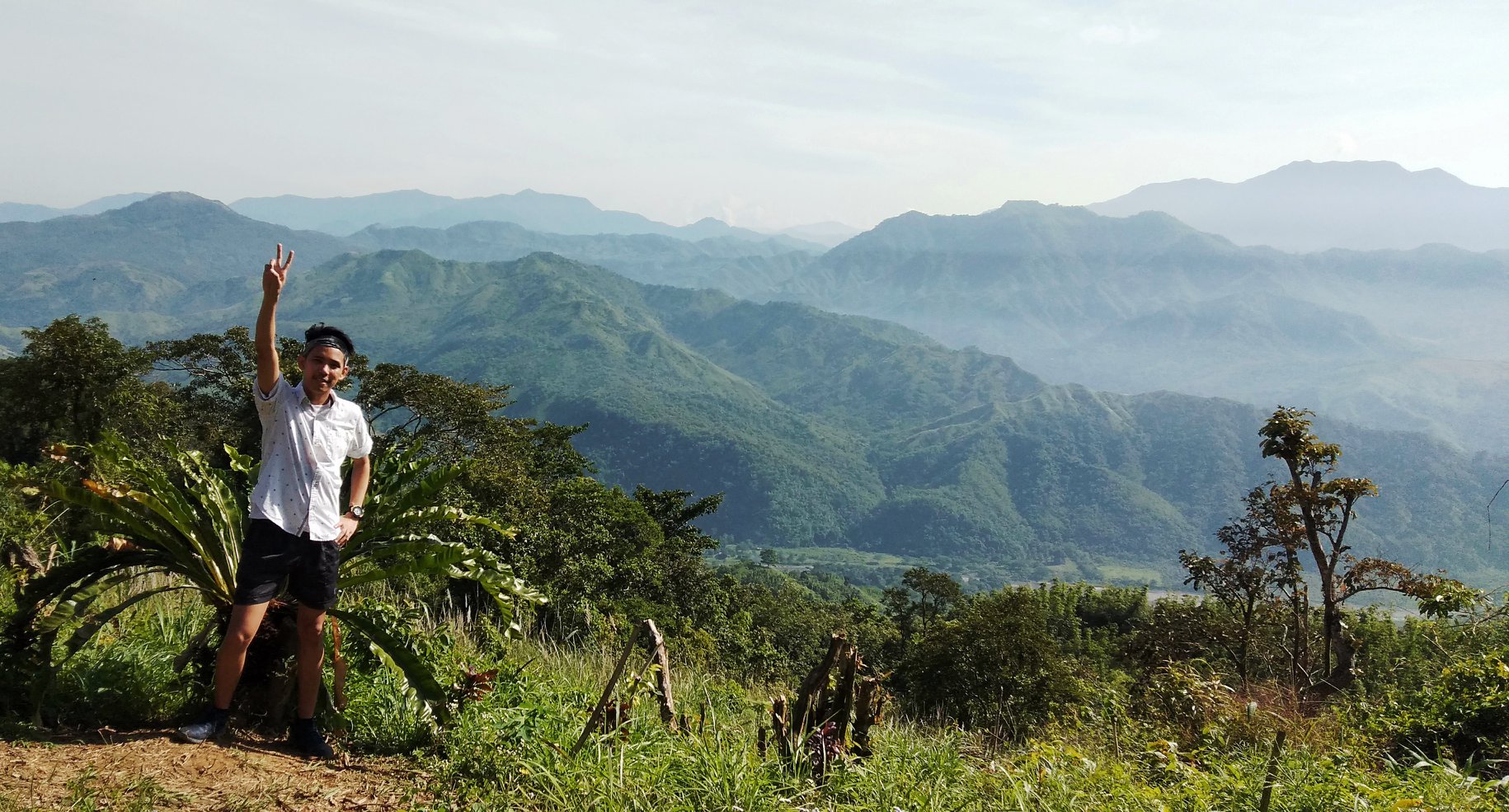
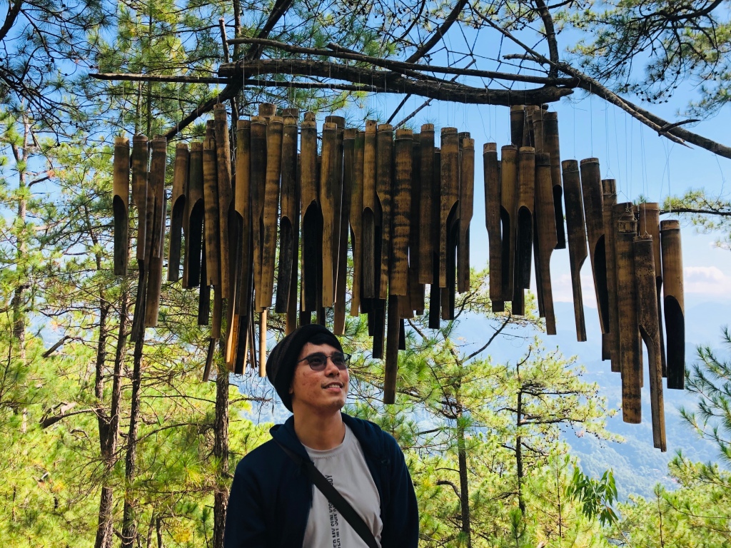
  1. Scenic views: Baguio City is surrounded by lush mountains, making it a great place to take in beautiful views of nature. The fresh pine-scented air and the peacefulness of the surroundings make it an ideal spot for a getaway.
  2. Cool climate: The city’s high altitude means it has a cool and comfortable climate, making it a great escape from the heat of the lowlands. The cool climate is perfect for relaxing and exploring the city without feeling the heat.
  3. Cultural heritage: Baguio City is home to many indigenous communities, and you can learn about their customs and traditions through various cultural shows and festivals. The cultural heritage of the city is something that I find fascinating and it’s always a pleasure to learn more about it.
  4. Delicious food: Baguio City has a variety of delicious food options, from traditional Igorot dishes to modern fusion cuisine. The food scene in Baguio City is diverse and it’s a great place to try something new.
  5. Shopping: Baguio City is famous for its markets, where you can find a wide range of products, from traditional handicrafts to modern fashion items. It’s a shopper’s paradise, there’s always something new to discover.
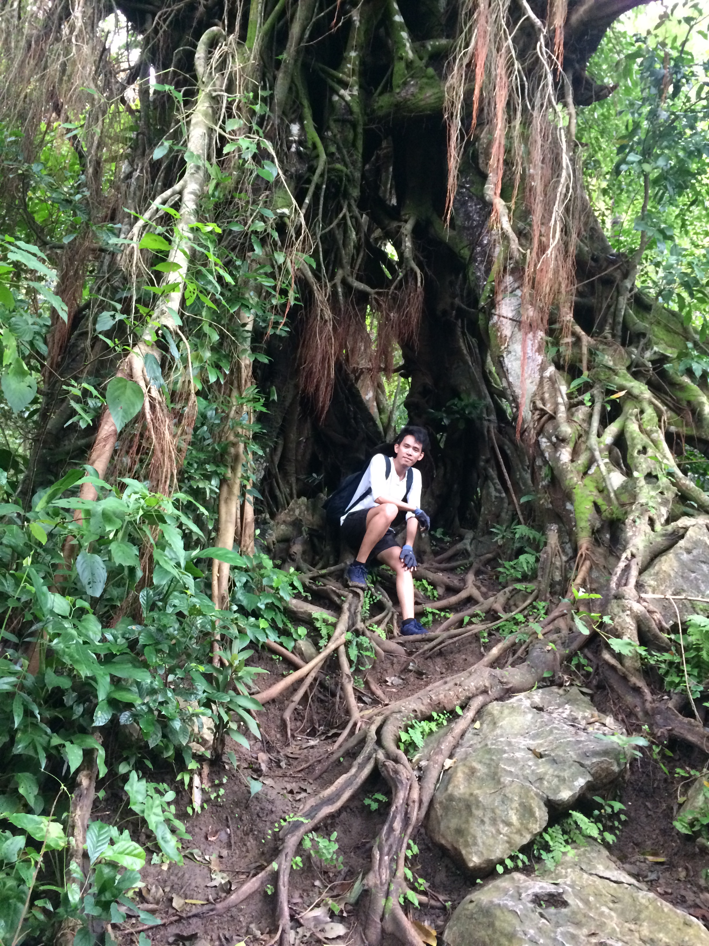
  6. Adventure activities: Baguio City offers a variety of adventure activities, such as hiking, biking, and zip-lining, that allow you to fully experience the natural beauty of the area. Whether you’re an adrenaline junkie or just looking for a way to explore the outdoors, Baguio City has something for everyone.
  7. Relaxation: Baguio City also offers a wide range of spas and wellness centers, making it the perfect place to relax and rejuvenate after a day of exploring. The relaxing atmosphere and the healing hot springs are the perfect way to end a day of adventure.

Overall, Baguio City is a must-visit destination in the Philippines. The combination of natural beauty, cultural heritage, delicious food, shopping, adventure activities and relaxation make it a perfect place for a getaway. The memories I’ve made in this city and the promise of new adventures keep me coming back.


Exploring the Hundred Islands: A Guide to the Top 3 Most Visited Islands

The Hundred Islands National Park, located in the province of Pangasinan in the Philippines, is a must-visit destination for anyone looking to explore the natural beauty of the country. The park is home to 124 islands, although only a few of them are open to visitors. Here is a brief guide to the Hundred Islands National Park and what you can expect to see and do there.

  1. Island hopping: The main attraction of the park is island hopping. Visitors can choose from a variety of tour packages, which typically include stops at several of the park’s most popular islands, such as Governor Island, Quezon Island, and Children’s Island. Each island offers a unique experience, from swimming and snorkeling to hiking and wildlife watching.
  2. Scenic views: The islands offer a variety of scenic views, from lush green landscapes to rocky cliffs and crystal-clear waters. The park is also a great place for bird watching, as it is home to a diverse range of bird species.
  3. Adventure activities: The park also offers a variety of adventure activities, such as kayaking, rock climbing, and ziplining. These activities are a great way to explore the islands and to get a different perspective on the natural beauty of the area.
  4. Accomodation: The park also offers a variety of accommodation options, from camping to guesthouses. It’s best to book in advance as the islands can get quite crowded during peak season.
  5. History: The islands have a rich history, from pre-colonial times to the Spanish and American occupation. Visitors can learn about the history of the islands at the Hundred Islands Environmental Museum and Research Center.
  6. Food: The island’s local seafood is a must-try for visitors. Fresh seafood such as grilled fish, squid and shrimps are readily available and prepared in various styles.

The three most visited islands in the park are:

  1. Governor Island: This is the largest island in the park and is the most popular among visitors. It offers a variety of activities, such as swimming, snorkeling, and hiking. The island is also home to several cottages and guesthouses, making it a great place to stay overnight.
  2. Quezon Island: This island is known for its white sandy beaches, crystal-clear waters, and beautiful coral reefs. It is a popular spot for swimming and snorkeling, and is also home to several cottages and guesthouses.
  3. Children’s Island: This island is a great destination for families, as it offers a variety of activities for children, such as a playground and a mini-zoo. The island is also home to several cottages, making it a great place for families to stay overnight.

It’s worth noting that the number of visitors to the islands and the popularity of each island can vary depending on the season, weather and other factors. It’s always best to check with the park management or tour operators before planning a visit.

All I can say is that the Hundred Islands National Park is a beautiful and diverse destination that offers visitors a chance to explore a variety of islands and enjoy a variety of activities. Whether you’re looking to relax and take in the scenic views or to get your adrenaline pumping with adventure activities, the park has something for everyone. The rich history and the delicious local seafood just add to the overall experience.

Beach and Cove Hopping at Mariveles, Bataan: Laki Beach and Five Fingers

Last summer, my friend invited me for a day tour somewhere in Bataan. That time, I have no idea where we’re exactly going. Sumama lang ako because she said we’re going to beach. Sino ba naman ako para tumanggi? BEACH daw eh!  G na agad. ‘Coz you know, I’m a Certified Beach Boy!

IMG20190317122855.jpg

So our destination for this unplanned getaway is the Five Fingers and Laki beach at Mariveles, Bataan.

Why is it called Five Fingers?

The five coves appeared to be a five-finger when viewed above. Look at the aerial shot, it really look like five fingers.

aerial-pic-five-fingers-laki-beach

Image source: Google Image (iamtravelinglight.com)

Laki beach is a privately-own beach resort. For this tour , it is the main destination. The entrance fee for a day trip is P300 while an overnight stay cost P400 (entrance fee might change as of this moment).

Five fingers is composed  of different spots: Talain Cove, Nagbintana Arc, Tinalakan Cliff Diving, Pulong Kawayan Bat Cave, and Apatot Beach. 

How to get there

By Land

From Manila — Mariveles, Bataan is accesible by private and public vehicles. Booking is easy, you do not need to book in advance. 

  1. Board a bus bound for Mariveles from Manila. Your can either go for Bataan Transit and Genesis. These bus company servethis route regularly. Fare is around 280-305 pesos.
  2. Alight at Mariveles and ride a jeep or tricycle bound for Barangay Balon. Tell the driver you’d like to stop at Porto for the boat rental. 

Note: For those who are only going on a day trip, the boat rental costs around P2000 to P2500. If you want to spend the night, the boat rent will cost around P3000 to P3500.


Destinations


Our first destination was the Laki beach. In all fairness, I didn’t expect this beach to be this good. I enjoyed its fine white sand plus the space is big enough to accomodate lot of tourists. We had our early lunch there since this is the only perfect place in the area to enjoy your lunch.


The beach is also picture-perfect. Dont miss to have your sun-kissed photo for your IG feed.
IMG_20190317_202212.jpg

After our beach bumming, we proceeded to our next destination which is the Nagbintana arc. This spot is known for its beautiful rock formation. This spot is good for photoshoot. If you like, you could also also swim around the area but it feels like a shark will going to attack you anytime soon.

Syempre, don’t forget your mala-crown prince or princess posing in this place.
IMG_20190318_205558.jpg

The view is surely breath-taking.

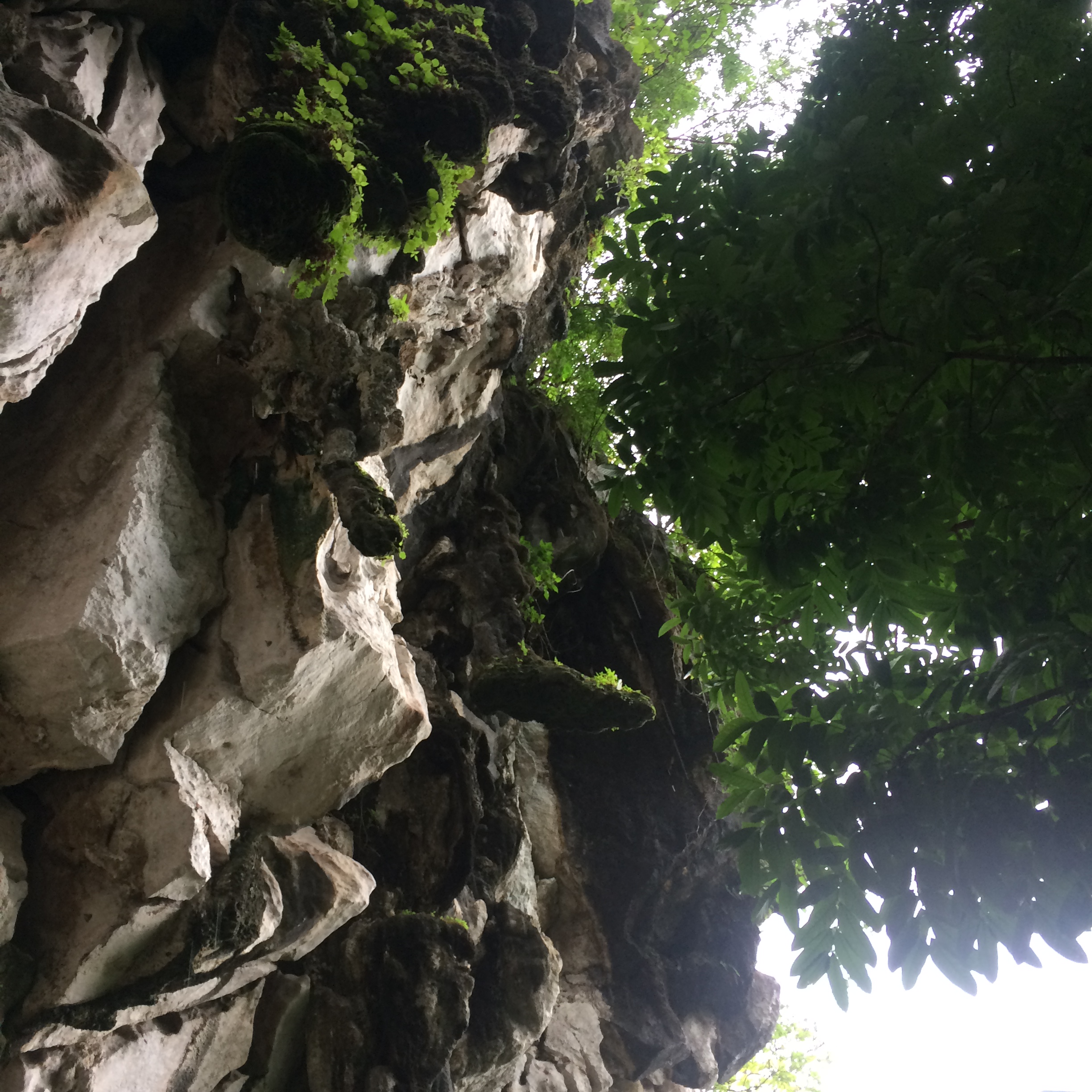
Nagbintana Arc: Five Fingers’ Cool Rock Formation

Tinalakan Cliff Diving Site


We didn’t stay long at the cliff diving site since most of us didn’t try to jump. After our picture-taking, we went back to the boat and proceeded to our next destination — the bat cave.

The cave tunnel is not that long. It’s easy to go inside, and its not that dark. There were also only few bats living in the cave.

As we swim, we noticed that the water temperature is slighly mixed. You’ll feel that its warm on the surface while its a bit cold underneath.


IMG_20190318_205845.jpg
Pulong Kawayan Bat Cave

To complete the five destination, our last itenary was another rock formation. I can’t remember the exact name of this place, but the tour guide said its name was “Plain Rock Formation”.

Again, you’ll witness an awesome rock formations in this place. The place is good for pictorial. You’ll also find an instagram worthy view in this area.

Five Fingers’ Plain Formation

So, that was our day tour experience at Five fingers and Laki beach. Unfortunately, we were not able to complete all the five coves. Our tour guide suggested for alternate destination since two of the coves are also beach.  We just spend more time on Laki beach instead. 

Overall, I really enjoyed every destinations. It has each own unique features. At hindi ka talaga mauumay.

So if you’re planning to go on a day tour or even overnight with your barkada, this place should be on your list.

Day Hike at Mt. Mapalad (Experience the Sea of Clouds)

I might refuse you when you invite me to watch at the cinema or go on a night out. But one thing is for sure, invite me to climb a mountain — and wherever is that — I will not think twice but go. Gladly, this mountain is just near Manila. You don’t need to travel for long hours to experience Sea of Clouds. 

Last October 2018, a friend of mine invited me for mountain hiking. It was good timing since we are on a semestral break; a great treat for ourselves.

Overview: Mt. Mapalad

Mt. Mapalad is named after a plant that grows on the mountain which looks like the palm of a hand. It is situated at Barangay San Andres, Tanay in the mountainous province of Rizal.

It stands at about 750+ meters above sea level (MASL) with a difficulty level of 3/9. Depending on your pace, you can reach the summit in 2 to 3 hours.

Mt. Mapalad is known for its two hand-shaped wooden stages in the summit. It has a “Bali-vibes” which spice things up. It also emulates Indonesia’s impeccable glamour.

IMG20181006102713

How to go there?

By public transport:

  • From Cubao, ride a jeep with the Antipolo Cogeo route. Take off at Cogeo Gate 2 or Cogeo Public Market and walk towards Cogeo City Mall where you will see the jeep terminal. Get a ride in one of the jeepneys, get off at Barangay San Andres.
  • In Barangay San Andres, there are tricycles on the side of the road, hire one of those, and inform the driver to take you to Mt. Mapalad registration area.

There, you’ve reached the jump-off point.

Way to the Summit

We started leaving the jump-off point at around 5:00 in the morning. At the start of our treck, the trail is almost flat. We walked for about 20-30 minutes before we reach the foot of the mountain. 

43331133_10210382381275395_5296153125072142336_o.jpg

In the middle of our hike, terrains were getting rough and slopes were getting steep. However, it was still manageable even when you’re just a beginner. Trails were dry and some areas were bit rocky. We also passed through diffrent brooks and streams. 

43419036_10210382380795383_7222282267534557184_o.jpg

Our pacing is slightly slow compare to the other hikers since we are in a group with a family who have their kids with them. The good thing about it, is that, we were able to savor the exquisteness of nature. While trekking, we passed through some areas which were shady because of trees that grows around while most of the trail were open-space where you’ll have to walk on tall grasses. 

43248210_10210368921898919_3424088687334391808_o.jpg

At around 6:30 am, sun started to rise and we’re just halfway to the summit. Unexpectedly, we witnessed sea of clouds along our way.

43452101_10210382380435374_2394605152699940864_o.jpgOur goal was to experience it on the summit, but its getting late. Luckily, the spot where we saw the sea of clouds is quite good enough. Our group decided to rest here and watch the clouds as it evaporates from the mountains. We also got a chance to take an instagram-worthy photo in this area.

IMG20181006065102

To witness the Sea of Clouds is one of the most exciting part when you are hiking. It is very rewarding to see this kind of scenery. The view will make you feel relaxed and its refreshing at the same time.


The Summit

We reach the summit at around 10:30 am and the sun was already up when we got there. No more sea of clouds but only sea of crowds. We didn’t expect its summit to be this crowded. Maybe because its sembreak, so most people are travelling.

To have your photo-op on the wooden palm stage, you need to que in line. Our guide save it for us. Unfortunately, we’re last in the line.

43462158_10210382381715406_9067294230988193792_o.jpg

While waiting for our turn, some of us rested. I took this chance to explore the summit and find other spots where I can breath some fresh air and took some beautiful photos. 

43350162_10210382383195443_1383730452933640192_o.jpg

Gladly, my friend was very supportive. We exchange camera’s and find the best spots for our pictorial. 

IMG20181006084417

Exploring the summit while waiting for our turn. This was on the other side of the mountain. Got the chance to have this photo while others are busy on the wooden palm stage.

After we had our picture on the wooden palm, we decided to go down. On our way back, we stop by on a falls. We swim there and the cold water of the falls helped us quench the heat of the sun and allowed us to  regain our energy. It was refreshing.

43175638_10210368923618962_6047825092530929664_o.jpg

If you’re a begginer and wanted to hike on a pebebeng trail, Mt. Mapalad is a must try. Its “bali-feels” is a bunos plus it’s just near Metro Manila.

Tips & Extras

  • Bring lots of water to stay hydrated. There are some stores along the way which sells cold drink, make sure you have your money with you if you want one.
  • Bring umbrella. Rain or shine, your umbrella is your friend. At firts, I manage to tolerate the weather but as the sun goes up, temperature gets high, better to have protection with the sun’s harmful UV rays.
  • Pack light foods. When hiking, you’ll loose lots of energy. Bring energy-packed foods which will help you replinish the energy you’ve lost.
  • Apply sunblock.
  • Most importantly, don’t rush. Enjoy the nature.
  • And please, bring your garbage with you. Wag magkalat!

Conquering Mt. Pamitinan: Day Hike at Montalban, Rizal

IMG_1802

For just a short drive from Metro Manila, province of Rizal has a lot of fun outdoor activities to offer. It’s a great destination for quick trip or day hikes, and the best introduction is Mt. Paminitan.

Mt. Paminitinan is a combination of modest and a bit challenging trail. It’s a perfect getaway for those who dont want to travel far but wanted to experience a refreshing view. 

20180819_101231(0)

Overview

Mt. Paminitinan is located in the Munipality of Rodriguez (which commonly known as Montalban), in the Province of Rizal.

It is most known for being part of Montalban Trilogy along with Mt. Binacayan and Hapunang Banoi; it’s one of the three favorites in the area.

It stand for about 426+ MASL, and depending on your pacing, it roughly takes 1.5-3 hours to reach the summit. With a difficluty level of 3/9, Mt. Pamitinan offers a challenging yet refreshing trail for first-time hikers. 

Mt. Paminitinan features unique Limestone Rock Formations and the Scenic view of Siera Madre and the Province of Rizal.

IMG_1921

How to go there

By commute:

  1. From Cubao. Find the Van Terminal in front of Jollibee Farmers Market going to Montalban. Ask the driver, there’s a direct trip there going to Montalban.
  2. From Sta. Lucia Mall in Cainta. Look or ask for jeepneys going to Montalban. Ask the driver to drop you off at Eastwood subdivision.
  3. Alight at eastwood subdivision. There are tricycles there that can take you to Sitio Wawa where the Department of Environment and Natural Resources (DENR) office is located.


The climb

At the start of our trek, we crossed the 80 meters hanging bridge that connects two Baryo over Wawa river. Our real journey started after we crossed this hanging bridge.

IMG_1820

IMG_1813

Along the trail, you’ll also pass by with its additional attraction such as the ancient ancient balete tree.

IMG_1831

Bamboo trees were also abundantly growing in the mountains.

1534761379289

There was also an option along the way where you can try rock climbing.

IMG_1867

Although it has minor diffulty, some part of the trail is a bit rocky . It has a minor bouldering part which makes this destination challenging for some beginners.

20180819_091821

There are three resting camps throughout the entire hike for you to catch your breath. However, there are no stores or source of water along the way so make sure you bring enough water for you to stay hydrated.

IMG_1870

The summit

The summit offers you a 360 degree view of its nearby places. At the peak, there’s a sight of its neighboring mountains (Mt. Binacayan &  Mt. Hapunang Banoi). You’ll also see the view of the vast Sierra Madre mountain range and the more immediate scenery is the Wawa River.

The space for picture taking is not that big so you have to que in line before you can have your pictorial in that area. This is where you can have your “buwis-buhay” photo op. Make to sure to maximise your alloted time to give chance to other hikers.

20180819_101339(0)

20180819_101201

20180819_101453

20180819_101108


Tips & Extras

  • Contact a guide prior to your trip. Having a guide is required when climbing Mt. Paminitinan. It’s better to reserve a slot especially when you’re going on a weekend. Below is the list of guides to contact:
    • Tour guides
      • Kuya Ronnie (Guide) – 09072395042
      • Kuya Emman (Guide) – 09493956589
      • Kuya Ogie (Guide) – 09473868778
      • Kuya Richard (Guide) – 09983266559
      • Kuya Joni (Barangay Wawa Official) – 09295497211
  • Bring handgloves and wear thick shoes.  Due to sharp and edgy limestones rocks along the trail, your guide will going to require you to wear handgloves. There are stores there which sells gloves, but if have spare one in your home, better to bring one. This will protect you from getting cuts and make your hike easier.
  • Bring lots of water and packed light food. There are no source of food and water on the mountain. When we go there, we just brought light snacks with us. Important reminder: Bring your trash with you, dont throw it anywhere.
  • If you want more challenge, you can opt to go for a twin hike or a try their trilogy.